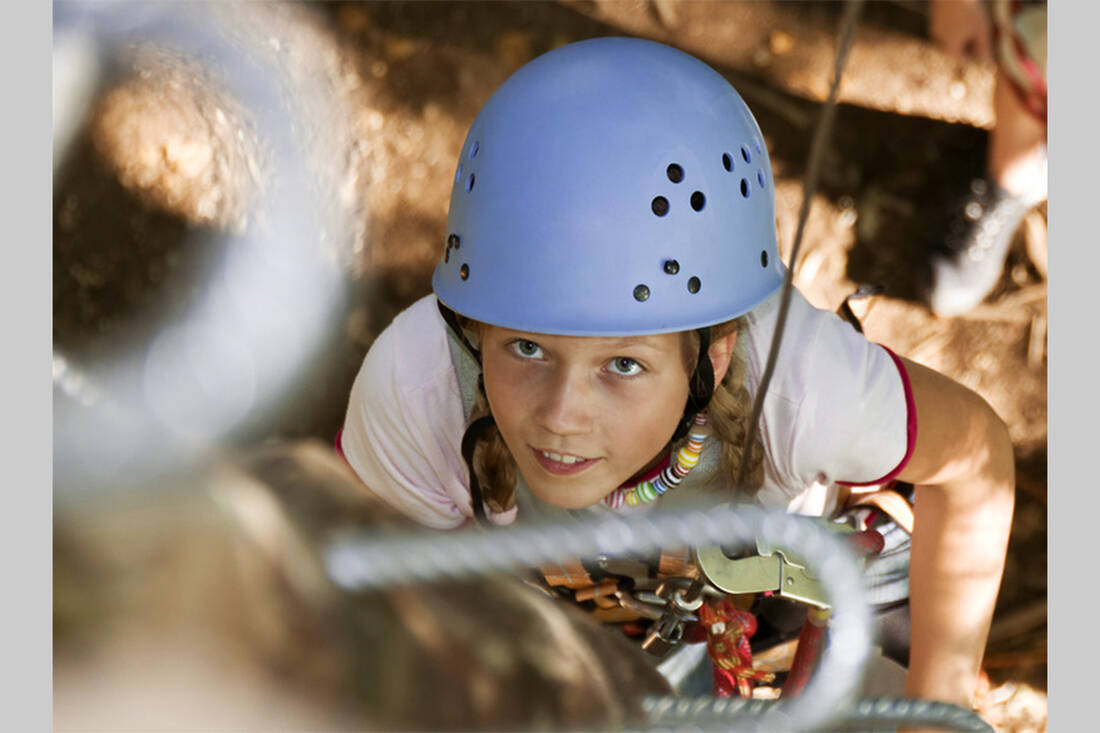
“Family-friendly” does not mean that the via ferrata can be done without any experience or prior knowledge. Suitable equipment - helmet, harness, via ferrata set - is also a basic requirement, and since via ferratas are usually somewhat exposed, they should only be done in good weather. Climbing also requires strength, so always take enough provisions and drinks for the children!
So that everyone has fun on the via ferrata, the routes must be chosen according to the age and abilities of the children. Under 4 years, only easy, not too long hikes with breaks are possible; between 4 and 6 years, children can already manage half-day hikes with breaks. From the age of 6 to 8, day trips are already feasible, from 8 to 12 years even slightly longer tours with their own, light backpack. After that, parents often have to make an effort to keep up with the kids.
10 Easy Via Ferratas for Children
Auer Klamm (Ötztal)
The short via ferrata to the spectacular waterfall in the Auer Klamm is actually an approach (rescue), as the gorge is very popular for canyoning tours. However, these can only be done in the company of trained guides, for climbing you simply climb to the bottom of the gorge and then back up. The via ferrata can be the beginning or end of a hike along the gorge.
Altitude entry: approx. 900 m
Altitude gorge: approx. 800 m
Duration: 20 minutes each
Difficulty level: B
Julius-Pock-Weg (Innsbruck/Karwendel)
The Julius-Pock-Weg to the Vordere Brandjochspitze in the Karwendel rewards with a magnificent view over the Inntal and the state capital Innsbruck. From the middle station of the Nordkettenbahn, you hike along the high path and then along the Schmidhubersteig to the Frau-Hitt-Sattel, from where it is not far to the entrance to the via ferrata. This is without great difficulties, but the mighty and rugged rock formations make it an alpine experience.
Altitude middle station Seegrube: 1905 m, entry: 2460 m
Altitude Vordere Brandjochspitze 2559 m
Duration approach: 2 h
Climbing time: 40 min.
Difficulty level: A/B
Steinsee (Zams)
The mountains around the Steinseehütte in the Lechtal Alps are a wonderful climbing area. The hut can be reached on foot from the car park at Alfutzalm in about 2.5 hours or via various high paths. It is advisable to plan an overnight stay. From the Steinseehütte, you reach the entrance following the blue markings in 1 hour. The via ferrata leads to the ridge between Steinkarturm and Steinkarspitze and offers a fantastic panorama of the Steinsee and the surrounding peaks.
Altitude Alfutzalm: 1261 m, Steinseehütte: 2069 m, entry: approx. 2300 m
Altitude ridge: 2550 m
Duration approach: 1 h
Climbing time: 1.5 h
Difficulty level: B/C
Flimspitze (Ischgl)
From the mountain station of the Viderjochbahn, follow the signs to the entrance of the via ferrata. The via ferrata initially leads steeply, but not too difficult, up a gully, then continues in a zigzag over sloping slabs to a ridge. From here, there is a final ascent to the summit. The safety features are excellent, and from the Filmspitze, you can enjoy a beautiful panoramic view. There are some more comfortable options for the descent.
Altitude Ischgl: 1376 m, Viderjoch, 2730 m, entry: approx. 2830 m
Altitude Filmspitze: 2928 m
Duration approach: 30 min.
Climbing time: 45 min.
Difficulty level: B/C
Sagzahn (Achensee)
From Maurach am Achensee, you can reach the Erfurter Hütte on foot or faster and more comfortably with the Rofanseilbahn. The hike from the hut to the entrance of the via ferrata takes about 2 hours. The via ferrata itself is short, easy, and very beautiful.
Altitude Erfurter Hütte: 1830 m
Altitude Sagzahn 2228 m
Duration approach: 2 h
Climbing time: 20 min.
Difficulty level: B
Widauersteig (Kaisergebirge)
The Scheffauer is a peak in the western part of the Kaisergebirge. Coming from Kufstein, you can save a few meters in altitude by using the chairlift. From the mountain station, you hike to the Kaindlhütte and then further to the foot of the Scheffauer. The entrance is marked with a sign, the via ferrata itself does not have major difficulties. From the summit, there is a magnificent view over the Inntal and the Hintersteiner See.
Altitude Kaindlhütte: 1293 m; entry: 1700 m
Altitude Scheffauer 2111 m
Duration approach: 2 h
Climbing time: 1 h
Difficulty level: A/B
Easy climbing routes in South Tyrol
Große Cir Spitze (Gröden)
The two Cir peaks are located in the Puez group at the Grödnerjoch. The via ferrata to the Große Cir Spitze is quite easy and can also be done with pleasure by less experienced climbers. From the summit, there is a magnificent panoramic view of the Dolomites. The via ferrata to the Kleine Cir Spitze is significantly more difficult and should only be attempted by those with alpine experience.
Altitude Grödnerjoch: 2137 m
Altitude Große Cir Spitze: 2592 m
Duration approach: 30 min.
Climbing time: 1 h
Difficulty level: B
Alpinisteig (Sextener Dolomiten)
Among the easier via ferratas in the Dolomites, the Alpinisteig is one of the most well-known and therefore often frequented. Built during the First World War by the Italian troops, the via ferrata was later adapted for tourism. The starting point is the Zsigmondy-Comici-Hütte, which can be reached from the Fischleintal in about 3 hours. From the hut, follow path 101 and the signposts (Alpinisteig). The safety features start under the Elferkofel at the Salvezza-Band and lead to the Elferscharte. Without too much difficulty, the via ferrata offers a wealth of unforgettable impressions, Inneres and Äußeres Loch, and the north face of the Elfer are unique in the Alps.
From the Elferscharte, you can either descend to the Fischleintal or to the mountain station of the Rotwandbahn. The continuation of the Alpinisteig to the Sentinellascharte is significantly more difficult (C) and not advisable for beginners.
Altitude Zsigmondy-Comici-Hütte: 2224 m
Altitude Elferscharte: 2650m
Duration Alpinisteig to Elferscharte: 2.5 h
Difficulty level: A/B
Sextener Rotwand (Sexten)
The route to the Sextener Rotwand is a beautiful and very popular via ferrata with only two "real" B sections, otherwise maximum category A. From the mountain station of the Rotwandbahn, you first walk downhill to the Rotwandwiese, then partly steeply uphill and along the Rotwandköpfe to a scree basin, where the via ferrata begins. At the entrance, there is a 40m long ladder, and the via ferrata is well secured where necessary. By the way, you are also moving on paths from the First World War, some of the war positions are still visible.
Altitude Rotwandwiese: 1914 m; entry: 2350 m
Altitude Sextener Rotwand 2939 m
Duration approach: 1 h 15’
Climbing time: 2 h
Difficulty level: B
Oskar Schuster Klettersteig (Gröden)
From the southwest, the Plattkofel resembles an endlessly long inclined plane, but on the other side, the rock walls almost drop vertically. The via ferrata here is one of the most beautiful in the Dolomites, but is a little sparing with the safety features and therefore requires great sure-footedness.
From the Sellajoch, take the gondola to the Langkofelscharte and descend from there to the Langkofelhütte. From here, hike up to the Plattkofelkar, where the entrance to the via ferrata is located, which leads to a few meters below the summit. Descent via the southwest flank to the Plattkofelhütte.
Altitude Sellajoch: 2137 m; Langkofelhütte: 2256 m; entry: 2540 m
Altitude Plattkofel 2958 m
Duration approach: 1.5 h
Climbing time: 2 h
Difficulty level: B
 A tip from the mountain guide Hias
 How do you like the content of this page?
Please give us your feedback!
Month
Vacation Offers
tips


