Search Navigation Map
Search

Mountain hike to the Schusterplatte (2957 m)

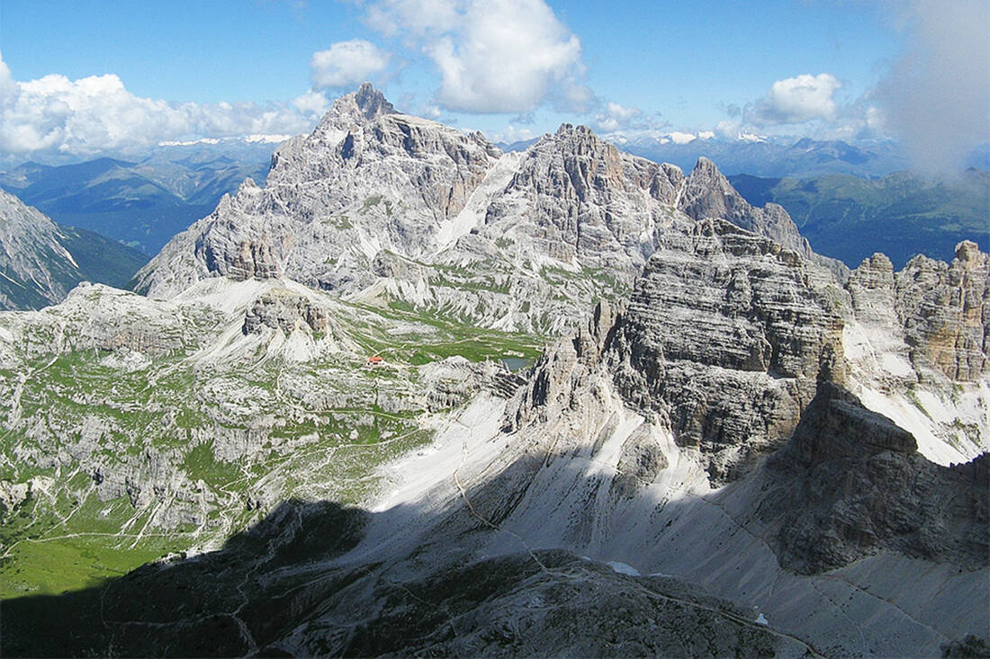
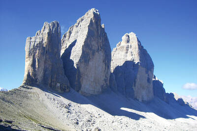
The Schusterplatte between the Innerfeld and Fischleintal valleys is an extremely rewarding summit with great views.

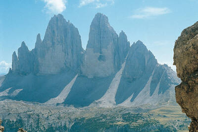
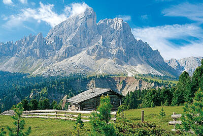
Dreischusterspitze, Schusterplatte and Paternkofel from the summit of the Kleine Zinne
Dreischusterspitze, Schusterplatte and Paternkofel from the summit of the Kleine Zinne - Christian Pellegrin - CC BY-SA 2.0

A worthwhile and highly recommended ascent, where in the south the red-yellow facades of the Paternkofel and the Tre Cime shine, while in the north the view is somewhat limited by the mighty Dreischusterspitze.

Route description: From the mountain hotel, take the bus or car to the Fischleintal valley. From there, the path leads to the Talschlusshütte and further on trail No. 102 to the right up towards the Dreizinnenhütte. Just before the hut comes into view, a signpost points right to the Schusterplatte, leads to the nearby Innichriedl (2381 m, historical trenches) and crosses the saddle. Then you climb up a scree slope covered with grass and follow to the left through a small valley section (historical war tunnels) to the Niederjoch (2465 m). Along old military roads, the path quickly leads into the Innichriedlkar, across the plain and directly into a wide scree gully. This is laboriously but easily overcome on a path marked with cairns, until you reach water-polished rock steps. Here keep to the left and climb up the rock steps (difficulty level 1. alpine grade). Above the steep steps, you reach a scree basin, cross it and climb steeply up a rocky slope to the Altensteinscharte. From a notch, there is a view of the impressive Weißlahn. To the left, the path leads over partly exposed ledges and scree slopes, past bizarrely shaped rocks, to the elongated and flat summit ridge, marked by cairns and a survey point at the northernmost end. The return is via the same route, with the option to stop at the Dreizinnenhütte or descend into the Innerfeldtal valley.

Tips and notes: The Schusterplatte, a popular destination among mountaineers, is characterized by its spectacular view and relatively easy access. It is located on the south-north axis of the Dreischuster group and offers a unique view of the nearby Dreischusterspitze. The summit, known for its elongated, flat shape and the cairns, promises an unforgettable experience. Despite the length of the tour (> 20 km), it is recommended for experienced mountain hikers.

How do you like the content of this page?
Please give us your feedback!

Recommended accommodations

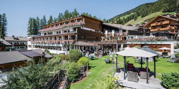
Alpenwellnesshotel St. Veit

Sesto ★★★★

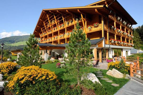
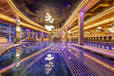
The Vitalpina Hotel St. Veit in the Sesto/Sexten Dolomites in South Tyrol makes your holiday into the highlight of the year. Wellness is given top priority at the hotel as relaxation is one of the most important things of a wonderful holiday. ,However, the Hotel St. Veit is not just a spa hotel in South Tyrol. It is also a member of the Vitalpina hotels and therefore meets high quality standards and is managed by the Karadar family with a great deal of passion and culinary skills.

Request   Details

Homepage   Heart icon notice
Icon Wellness Hotel Icon Hiking Hotel Icon Ski Hotel Icon Conference Hotel Icon Luxury Hotel

Sport & Kurhotel Bad Moos

Sesto ★★★★s

Surrounded by fields and forests, the Bad Moos – Dolomites Spa Resort stands at the entrance to the Drei Zinnen/Tre Cime Nature Park, part of the Dolomites, a UNESCO world heritage site. It is one of the original spa hotels of South Tyrol, featuring its own sulphur spring and holistic health programmes. The resort‘s Termesana spa and health area is spacious and offers high-quality treatments. Guests can stay in one of three buildings, each with its own individual style – exclusive, ...

Request   Details

Homepage   Heart icon notice
Hotel of the
Month
Hotel Plunhof

★★★★sAlto Adige

Hotel Plunhof
  • most family-friendly wellness hotel
  • enjoy the winter landscape
  • cross-country skiing paradise
  • Spa Minera Acqua Minera
  • spicy wines
  • be active together

Top Hotels

The best
tips
more on this topic
Stelvio Pass (left) and Rötlspitze (far right)
Foto: Armin Kübelbeck (modified by Svíčková and suedtirol-tirol) - CC BY-SA 3.0
8 Peaks March (Vinschgau)
Passeier Valley towards Merano
Urheber: Unbekannt - PD
Passeier High Trail (Passeier Valley)
Tribulaun Hut on the last meters of the hut climb
Photo: Wikipedia-User: Cactus26 - CC BY-SA 3.0
From the Tribulaun to the Magdeburger Hut
Partschinser Waterfall
Markus Rungg - CC-by-sa 3.0/de
Partschins Waterfall
South Tyrolean Schlinig Valley
Photo: Wikipedia-User: Mawamo - GFDL
Hike to the Pfaffenseen (2222 m)
Dreischusterspitze, Schusterplatte and Paternkofel from the summit of the Kleine Zinne
Christian Pellegrin - CC BY-SA 2.0
Mountain hike to the Schusterplatte (2957 m)
The Laugenspitze from the northwest
Photo: Wikipedia-User: Thesurvived99 - GFDL
Laugenspitze (2433 m)
View of Roen from Karnol
Photo: Wikipedia-User: Plentn - Public Domain
Hike to Roèn (2116 m)
Radlsee and Radlseehütte, seen from the Königsangerspitze.
Photo: Wikipedia-User: Svickova - Public Domain
Hike to Radlsee (2196 m)
The Hirzer Peak (left, 2781m) from the west
Photo: Wikipedia-User: Stevie-Ray78 - CC BY-SA 3.0
Hike to the Hirzer (2781 m)
Spronser Lakes: Green Lake - Texel Group Nature Park
Photo: Wikipedia-User: Noclador - CC BY-SA 3.0
Spronser Lakes Plateau (2126 - 2589 m)
Muthöhfe auf der Mutspitze
Photo: Wikipedia-User: Thesurvived99 - CC BY-SA 3.0
Hike to the Mutspitze (2295 m)

Vacation Offers


Close
Close